Quang Binh is a coastal province in North Central Vietnam. Quang Binh is located in the narrowest place in the east-west direction of Vietnam. It borders Ha Tinh province to the north, Quang Tri province to the south, Lao PDR to the west, and the Eastern Sea to the east. Quang Binh tourism in recent years attracted a lot of tourists, because this land has many attractions.
A resort on the shores of Nhat Le beach
Here are the tourist attractions can not go through when touring Quang Binh:
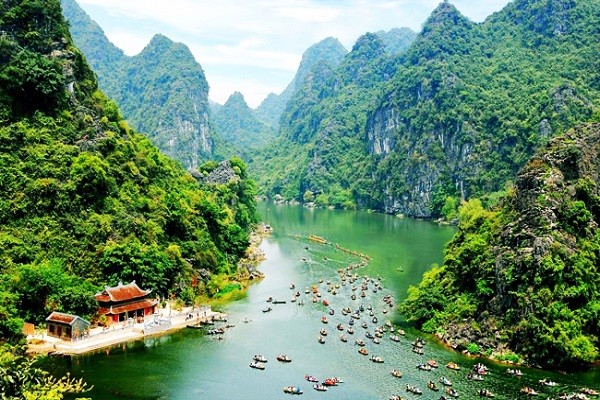
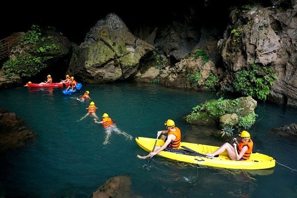
Phong Nha – Ke Bang National Park is located 50 km from Dong Hoi and is a wonderland located deep in the mountain, 800 to 900 m from the peak. Length 7729 m, there are 14 caves due to underground river 13.969 m long soluble limestone formed. Phong Nha-Ke Bang National Park was recognized as a World Natural Heritage by UNESCO in 2003. The Phong Nha cave is a beautiful one with underground rivers and seven largest ones: the longest water cave; The highest and widest store; Sandy beach, the largest and most beautiful rocks; The most beautiful underground lake; Stalactites are magnificent and most miraculous; The longest underground river in Vietnam; The broadest and most beautiful dry cave.
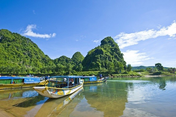
Son river on the way to Phong Nha cave
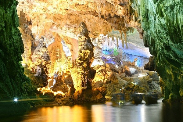
Phong Nha cave
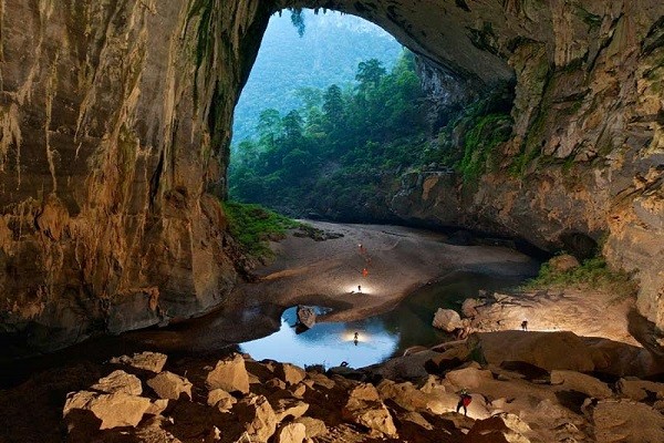
Son Đoong
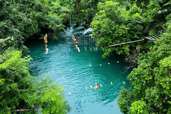
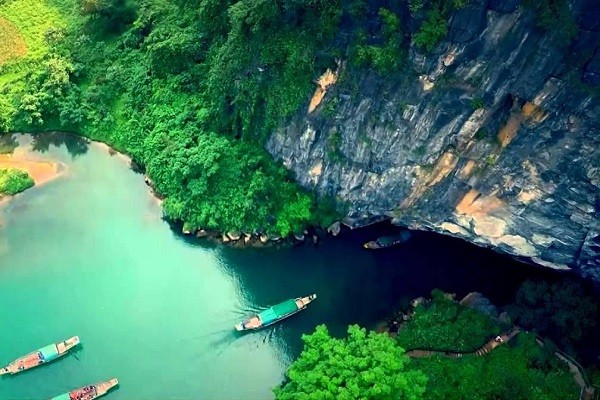
Suoi Mooc
Monuments Tam Toa Church: Tam Toa Church is a Catholic church located on Nguyen Du Street, Dong My Ward, Dong Hoi City, Quang Binh Province. The church was built in 1886.
Nhat Le River: Nhat Le River is a beautiful river of Central Vietnam. The name of the river means “the splendor of the sunlight” was praised in the ancient verse of Hu Tian Du “no matter how much you wish” means “the glare of sunlight is not Where is it not coming? ”
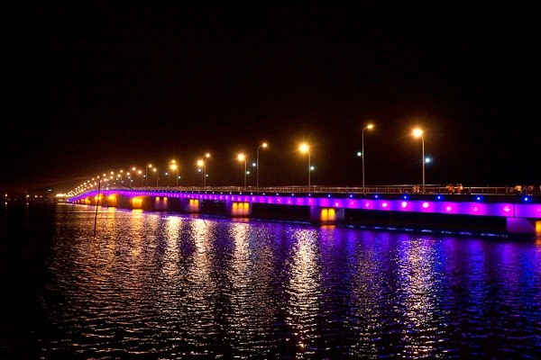
Nhat Le bridge crosses the Nhat Le river at night
Chay River – Dark Cave: Chay River is a tributary of the Son River with a length of about 10 km, gentle flowing water, clear water and many endemic fish such as Cyprinus centralus, Cyprinus crown sp., Phong Nha (Chela quangbinhensis) and Hemibagrus vietnamensis. The Chay River hides in the middle of the Phong Nha girders with cave systems such as Heaven, Mother Bong Son, Dark Caves …
Dark caves were emigrated very early, during the war years against the Americans and were used by the locals as a shelter to avoid bombs.
Chay River – Dark caves
Nhat Le beach is a beach in Central Vietnam. With tropical monsoon climate, divided into two seasons: rainy season and dry season. Nhat Le beach as a monumental painting of green water
Coming to Nhat Le beach, you will feel the scenery here is wonderful, charming and charming. Nhat Le sea cruise in Quang Binh has golden sand beaches under the azure forest with many beautiful beaches, sparkling jade and unpolluted sea water.
Nhat Le beach is the natural gift of white sand and clear blue sea, also looks wild. This is probably the favorite tour of tourists to tour Quang Binh. Since long time Nhat Le beach tourism famous for a sky, clouds, rivers, water, wind, air and sea gas. Nhat Le beach stretches a white sand color, the weather is cool, the beach is clean like new mattress, smooth sand, iridescent can ride or play football comfortably.
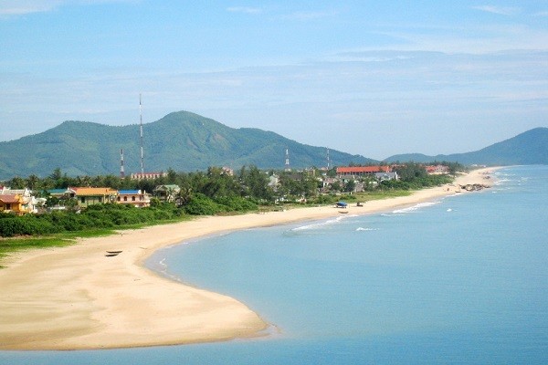
Nhat Le beach, one of the beautiful beaches of Central Vietnam
Vung Chua – Dao Yen is located 7km south of Ngang Pass, in Tho Son village, Quang Dong commune, Quang Trach district. The last resting place of General Vo Nguyen Giap is the Tho Mountain, the dragon nose in the Vung Chua – Yen Island range of Hoanh Son Range pierced the sea. The area of Vung Chua – Dao Yen is 10 km south of Ngang Pass to the South and only 2 km far from the National Highway 1. This is a popular tourist resort in the North of Quang Binh Province. Vung Chua day by day, the General came immediately to all the routes of Quang Binh travel.
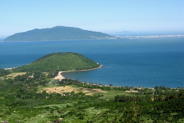
Vung Chua – Dao Yen